
Thank you for supporting this site ❤️
Make a donation
Make a donation
Cranfield topographic map
Click on the map to display elevation.
Thank you for supporting this site ❤️
Make a donation
Make a donation
About this map
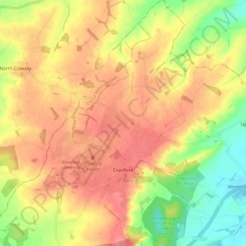
Name: Cranfield topographic map, elevation, terrain.
Location: Cranfield, Central Bedfordshire, England, United Kingdom (52.05026 -0.65807 52.11068 -0.57832)
Average elevation: 88 m
Minimum elevation: 42 m
Maximum elevation: 121 m
Thank you for supporting this site ❤️
Make a donation
Make a donation