
Dillon County topographic map
Interactive map
Click on the map to display elevation.
About this map
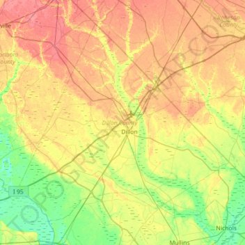
Name: Dillon County topographic map, elevation, terrain.
Location: Dillon County, South Carolina, United States (34.23091 -79.63350 34.62104 -79.07121)
Average elevation: 36 m
Minimum elevation: 10 m
Maximum elevation: 66 m
Other topographic maps
Click on a map to view its topography, its elevation and its terrain.