
Waiterimu topographic map
Click on the map to display elevation.
About this map
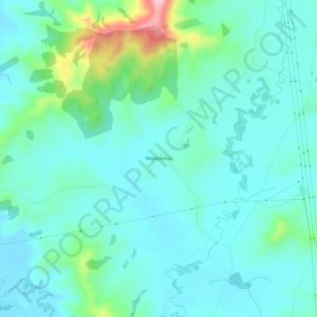
Name: Waiterimu topographic map, elevation, terrain.
Location: Waiterimu, Waikato District, Waikato, New Zealand (-37.49409 175.25356 -37.45409 175.29356)
Average elevation: 54 m
Minimum elevation: 11 m
Maximum elevation: 239 m
Waikato District trails, hiking, mountain biking, running and outdoor activities
Other topographic maps
Click on a map to view its topography, its elevation and its terrain.