
Isle of Wight topographic map
Interactive map
Click on the map to display elevation.
About this map
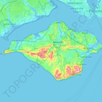
Name: Isle of Wight topographic map, elevation, terrain.
Location: Isle of Wight, South East England, England, United Kingdom (50.57478 -1.58658 50.76734 -1.06986)
Average elevation: 17 m
Minimum elevation: -4 m
Maximum elevation: 240 m