
Thank you for supporting this site ❤️
Make a donation
Make a donation
Kalamb topographic map
Click on the map to display elevation.
Thank you for supporting this site ❤️
Make a donation
Make a donation
About this map
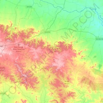
Name: Kalamb topographic map, elevation, terrain.
Location: Kalamb, Yavatmal, Maharashtra, India (20.18524 78.20935 20.55586 78.51673)
Average elevation: 322 m
Minimum elevation: 214 m
Maximum elevation: 469 m
Thank you for supporting this site ❤️
Make a donation
Make a donation
Other topographic maps
Click on a map to view its topography, its elevation and its terrain.