
Thank you for supporting this site ❤️
Make a donation
Make a donation
Ansad topographic map
Click on the map to display elevation.
Thank you for supporting this site ❤️
Make a donation
Make a donation
About this map
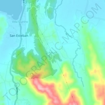
Name: Ansad topographic map, elevation, terrain.
Location: Ansad, Ilocos Sur, Ilocos Region, 2705, Philippines (17.30463 120.43792 17.34463 120.47792)
Average elevation: 47 m
Minimum elevation: 0 m
Maximum elevation: 201 m
Thank you for supporting this site ❤️
Make a donation
Make a donation
Other topographic maps
Click on a map to view its topography, its elevation and its terrain.