
Eastbourne topographic map
Click on the map to display elevation.
About this map
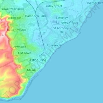
Name: Eastbourne topographic map, elevation, terrain.
Location: Eastbourne, East Sussex, England, United Kingdom (50.73343 0.20935 50.81308 0.33998)
Average elevation: 36 m
Minimum elevation: -6 m
Maximum elevation: 198 m
Other topographic maps
Click on a map to view its topography, its elevation and its terrain.