
Thank you for supporting this site ❤️
Make a donation
Make a donation
Charleston topographic map
Click on the map to display elevation.
Thank you for supporting this site ❤️
Make a donation
Make a donation
About this map
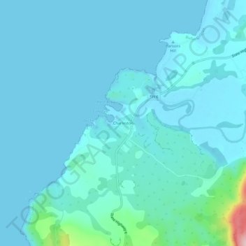
Name: Charleston topographic map, elevation, terrain.
Location: Charleston, Buller District, West Coast, New Zealand (-41.92466 171.41717 -41.88466 171.45717)
Average elevation: 24 m
Minimum elevation: -1 m
Maximum elevation: 255 m
Buller District trails, hiking, mountain biking, running and outdoor activities
Thank you for supporting this site ❤️
Make a donation
Make a donation
Other topographic maps
Click on a map to view its topography, its elevation and its terrain.