
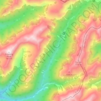
Right Branch Maruia River topographic map
Interactive map
Click on the map to display elevation.
About this map
Name: Right Branch Maruia River topographic map, elevation, terrain.
Average elevation: 1,241 m
Minimum elevation: 645 m
Maximum elevation: 1,818 m
Buller District trails, hiking, mountain biking, running and outdoor activities
Other topographic maps
Click on a map to view its topography, its elevation and its terrain.
Reefton
New Zealand > West Coast > Buller District
Located in the Inangahua Valley at an altitude of 194m, Reefton falls under the Köppen-Geiger climate classification of Cfb (Oceanic), though the town's sheltered inland location lends its climate less maritime influence than coastal areas; as such, Reefton has recorded both the extreme highest temperature of…
Average elevation: 310 m
Lewis Pass
New Zealand > West Coast > Buller District
Lewis Pass is the northernmost of the three main mountain passes through the Southern Alps in the South Island of New Zealand. With an elevation of 907 metres, it is slightly lower than Arthur's Pass and higher than Haast Pass.
Average elevation: 1,039 m