
Thank you for supporting this site ❤️
Make a donation
Make a donation
Meru topographic map
Click on the map to display elevation.
Thank you for supporting this site ❤️
Make a donation
Make a donation
About this map
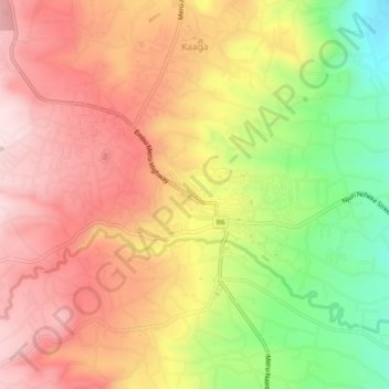
Name: Meru topographic map, elevation, terrain.
Location: Meru, Meru County, East Kenya, 60200, Kenya (0.02899 37.62766 0.06855 37.67444)
Average elevation: 1,603 m
Minimum elevation: 1,375 m
Maximum elevation: 1,770 m
Thank you for supporting this site ❤️
Make a donation
Make a donation
Other topographic maps
Click on a map to view its topography, its elevation and its terrain.