
Santa Rosa topographic map
Click on the map to display elevation.
About this map
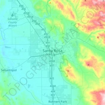
Name: Santa Rosa topographic map, elevation, terrain.
Location: Santa Rosa, Sonoma County, California, United States (38.36433 -122.83434 38.50805 -122.56999)
Average elevation: 136 m
Minimum elevation: 6 m
Maximum elevation: 731 m
Other topographic maps
Click on a map to view its topography, its elevation and its terrain.