
Peratta topographic map
Click on the map to display elevation.
About this map
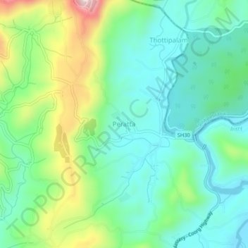
Name: Peratta topographic map, elevation, terrain.
Location: Peratta, Iritty, Kannur District, Kerala, 670706, India (12.05184 75.68750 12.09184 75.72750)
Average elevation: 142 m
Minimum elevation: 32 m
Maximum elevation: 409 m
Other topographic maps
Click on a map to view its topography, its elevation and its terrain.