
Loudon County topographic map
Interactive map
Click on the map to display elevation.
About this map
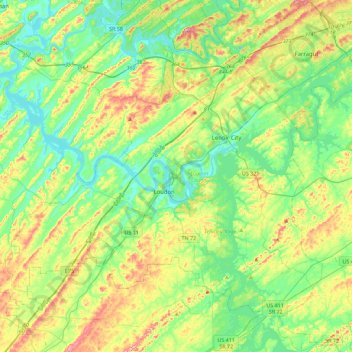
Name: Loudon County topographic map, elevation, terrain.
Location: Loudon County, Tennessee, United States (35.61055 -84.58500 35.90325 -84.13333)
Average elevation: 281 m
Minimum elevation: 222 m
Maximum elevation: 405 m
Other topographic maps
Click on a map to view its topography, its elevation and its terrain.
Shepherd
United States > Tennessee > Hamilton County > Chattanooga > Shepherd
Average elevation: 212 m