
Thank you for supporting this site ❤️
Make a donation
Make a donation
Arrochar topographic map
Click on the map to display elevation.
Thank you for supporting this site ❤️
Make a donation
Make a donation
About this map
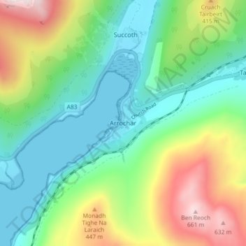
Name: Arrochar topographic map, elevation, terrain.
Location: Arrochar, Argyll and Bute, Scotland, G83 7AD, United Kingdom (56.17547 -4.76807 56.21547 -4.72807)
Average elevation: 217 m
Minimum elevation: -1 m
Maximum elevation: 679 m
Thank you for supporting this site ❤️
Make a donation
Make a donation
Other topographic maps
Click on a map to view its topography, its elevation and its terrain.
Thank you for supporting this site ❤️
Make a donation
Make a donation
Thank you for supporting this site ❤️
Make a donation
Make a donation