
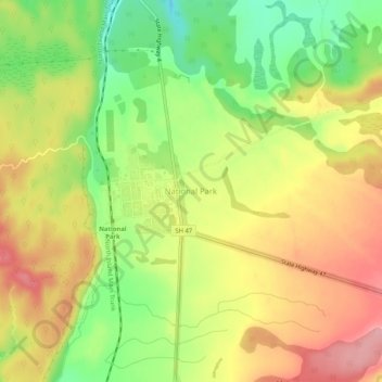
National Park topographic map
Interactive map
Click on the map to display elevation.
National Park topographic map, elevation, terrain
National Park
Under the Köppen-Geiger climate classification, National Park has an oceanic climate (Cfb). February is the warmest month, with an average temperature of 14.8 °C, while July is the coldest month with an average temperature of 4.5 °C. Due to an altitude of 822 metres, winters are cold, and generally winter afternoons stay below 10 °C. Frosts are common from May to September, although they can occur during the warmer months. Snow is also a common occurrence in the colder months, sometimes accumulating for several days on end. The summer temperatures are moderate due to the altitude of the village, resulting in cool nights and mild to warm days. The mountains around the village are popular for hiking and mountain biking during the summer. The summer afternoon temperatures often exceed 20 °C, and sometimes reaching 25 °C. The wettest month is July, with 225 mm of precipitation, while February is the driest, with an average of 115 mm, making the climate of National Park lean towards a cool-summer Mediterranean climate (Csb). Overall, the year-round average temperature is 9.6 °C.
About this map
Name: National Park topographic map, elevation, terrain.
Average elevation: 820 m
Minimum elevation: 754 m
Maximum elevation: 879 m
Other topographic maps
Click on a map to view its topography, its elevation and its terrain.
Mount Tongariro
New Zealand > Manawatu-Whanganui > Ruapehu District
The high altitude and severe alpine climate between March and October allow snowfall in the winter (there are commercial ski-fields at neighbouring Mount Ruapehu) and rain can freeze, causing verglas; in contrast in the mid to late summer, the mountains can be bare apart from remnant patches of snow in…
Average elevation: 1,675 m
Taumarunui
New Zealand > Manawatu-Whanganui > Ruapehu District
Under the Köppen, Taumarunui has an Oceanic climate:(Cfb). Due to location, low altitude and Geography surroundings, Taumarunui is more liable to warm to hot summers than other central North Island centres and in winter Taumarunui is cold and frosty. Rainfall yearly is 1,449 mm (57.047244 in). Annual sunshine…
Average elevation: 245 m
Waiouru
New Zealand > Manawatu-Whanganui > Ruapehu District
Because of its high altitude and close proximity to Mt Ruapehu, Waiouru's climate is cold throughout the year, unlike other North Island centres, and particularly cold when the wind blows from the mountain. The Desert Road is regularly closed in winter owing to heavy snowfalls. Waiouru's climate can be…
Average elevation: 817 m
Sunshine Settlement
New Zealand > Manawatu-Whanganui > Ruapehu District > Taumarunui
Average elevation: 214 m
Ohakune
New Zealand > Manawatu-Whanganui > Ruapehu District
Ohakune is located in the Ruapehu District and the Manawatū-Whanganui region, to the immediate south-west of the slopes of the Mount Ruapehu stratovolcano. The town is 25 kilometres (16 miles) west of Waiouru, 70 kilometres (43 miles) northeast of Whanganui, 287 kilometres (178 miles) north of Wellington and…
Average elevation: 619 m
Mount Ruapehu
New Zealand > Manawatu-Whanganui > Ruapehu District
Ruapehu has a polar tundra climate (Köppen: ET) on the upper slopes, with average temperatures ranging from −4–15 °C in summer and −7–7 °C in winter, depending on elevation and cloudiness. On the lower slopes, Ruapehu has a subpolar oceanic climate (Köppen: Cfc).
Average elevation: 2,474 m