
Sumbawa topographic map
Interactive map
Click on the map to display elevation.
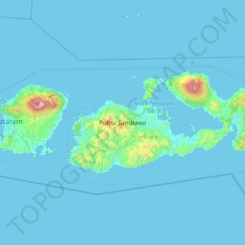
Sumbawa topographic map, elevation, terrain
About this map
Name: Sumbawa topographic map, elevation, terrain.
Location: Sumbawa, West Nusa Tenggara, Lesser Sunda Islands, Indonesia (-9.10936 116.71527 -8.08046 119.19209)
Average elevation: 79 m
Minimum elevation: 0 m
Maximum elevation: 3,497 m
Other topographic maps
Click on a map to view its topography, its elevation and its terrain.
Rinjani
Indonesia > West Nusa Tenggara
In September 1995 an aviation report was issued concerning an unconfirmed ash cloud from Rinjani. A NOTAM about volcanic activity from Rinjani was issued by the Bali Flight Information Region on the morning of 12 September. An ash cloud was reportedly drifting to the south west with the cloud top around 4 km…
Average elevation: 3,071 m