
Te Hoe topographic map
Interactive map
Click on the map to display elevation.
About this map
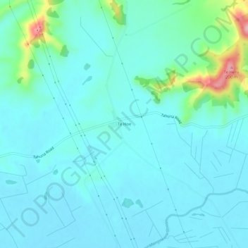
Name: Te Hoe topographic map, elevation, terrain.
Location: Te Hoe, Waikato District, Waikato, 3792, New Zealand (-37.53374 175.30212 -37.49374 175.34212)
Average elevation: 41 m
Minimum elevation: 15 m
Maximum elevation: 184 m
Other topographic maps
Click on a map to view its topography, its elevation and its terrain.
Lake Ohinewai
New Zealand > Waikato > Te Hoe
Lake Ohinewai, Tahuna-Ohinewai Road, Te Hoe, Waikato District, Waikato, 3373, New Zealand
Average elevation: 15 m