
Gallatin County topographic map
Interactive map
Click on the map to display elevation.
About this map
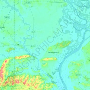
Name: Gallatin County topographic map, elevation, terrain.
Location: Gallatin County, Illinois, United States (37.57308 -88.37530 37.91621 -88.02587)
Average elevation: 122 m
Minimum elevation: 99 m
Maximum elevation: 302 m
Other topographic maps
Click on a map to view its topography, its elevation and its terrain.
Sturbridge Village
United States > Illinois > Winnebago County > Sturbridge Village
Average elevation: 230 m