
Make a donation
Feigh topographic map
Click on the map to display elevation.
Make a donation
About this map
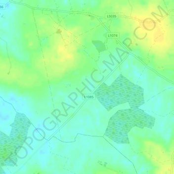
Name: Feigh topographic map, elevation, terrain.
Average elevation: 64 m
Minimum elevation: 55 m
Maximum elevation: 75 m
Make a donation
Other topographic maps
Click on a map to view its topography, its elevation and its terrain.
Make a donation
Make a donation
Make a donation
Make a donation
Make a donation
Make a donation
Limerick
Limerick's climate is classified as temperate oceanic (Köppen Cfb). Met Éireann maintains a climatological weather station at Shannon Airport, 20 kilometres west of the city in County Clare. Shannon Airport records an average of 977 millimetres of precipitation annually, most of which is rain. Limerick has a…
Average elevation: 10 m
Make a donation
Make a donation
Make a donation
Make a donation
Ferns
Ireland > County Wexford > Ferns
The 19th-century population peaked in 1851, but never reached the levels of medieval times. Lewis's Topography of 1834 claimed the town "consists chiefly of one irregular street, and contains 106 houses indifferently built, retaining no trace of its ancient importance". The Abbey, St.Peter's Church (Catholic…
Average elevation: 60 m
Make a donation