
Grinde topographic map
Interactive map
Click on the map to display elevation.
About this map
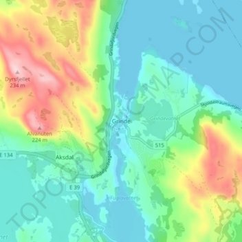
Name: Grinde topographic map, elevation, terrain.
Location: Grinde, Tysvær, Rogaland, 5570, Noruega (59.40907 5.44361 59.44907 5.48361)
Average elevation: 66 m
Minimum elevation: -1 m
Maximum elevation: 229 m
Other topographic maps
Click on a map to view its topography, its elevation and its terrain.