
Stavanger topographic map
Interactive map
Click on the map to display elevation.
About this map
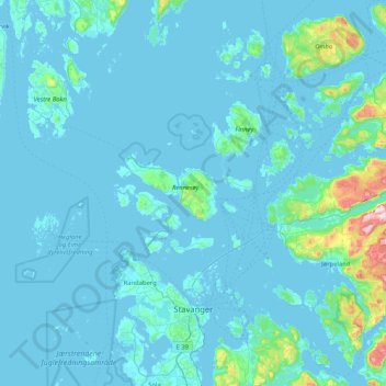
Name: Stavanger topographic map, elevation, terrain.
Location: Stavanger, Rogaland, Noruega (58.88466 5.49903 59.31210 6.13131)
Average elevation: 42 m
Minimum elevation: -1 m
Maximum elevation: 755 m
Other topographic maps
Click on a map to view its topography, its elevation and its terrain.