
Make a donation
Lynchburg topographic map
Click on the map to display elevation.
Make a donation
Lynchburg
Lynchburg has a four-season humid subtropical climate (Köppen Cfa), with cool winters and hot, humid summers. The monthly daily average temperature ranges from 35.9 °F (2.2 °C) in January to 76.0 °F (24.4 °C) in July. Nights tend to be significantly cooler than days throughout much of the year due in part to the moderate elevation. In a typical year, there are 27.4 days with a high temperature 90 °F (32 °C) or above, and 6.2 days with a high of 32 °F (0 °C) or below. Snowfall averages 11.6 inches (29 cm) per season but this amount varies highly with each winter; the snowiest winter is 1995–96 with 56.8 in (144 cm) of snow, but the following winter recorded only trace amounts, the least on record. The average snowiest month is February which corresponds with the annual peak in nor'easter activity. The plant hardiness zone is 7b with an average annual extreme minimum air temperature of 5 °F (−15 °C).
Make a donation
About this map
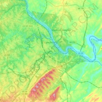
Name: Lynchburg topographic map, elevation, terrain.
Location: Lynchburg, Virginia, United States (37.33264 -79.27139 37.46940 -79.08449)
Average elevation: 229 m
Minimum elevation: 142 m
Maximum elevation: 404 m
Make a donation
Other topographic maps
Click on a map to view its topography, its elevation and its terrain.
Make a donation
Hawksbill
United States > Virginia > Madison County
Hawksbill Mountain is a mountain with an elevation of 4,050 feet (1,234 m). Marking the border between Madison County and Page County in Virginia, the summit of Hawksbill Mountain is the highest point in Shenandoah National Park, as well as the highest point in both Madison and Page counties.
Average elevation: 993 m
Make a donation
Make a donation
Make a donation