Geolocate

Xinwu District topographic map

Interactive map

Click on the map to display elevation.

About this map

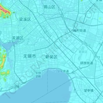
Name: Xinwu District topographic map, elevation, terrain.

Location: Xinwu District, Wuxi City, Jiangsu, 214000, China (31.44740 120.30723 31.58516 120.55003)

Average elevation: 7 m

Minimum elevation: -13 m

Maximum elevation: 313 m

Other topographic maps

Click on a map to view its topography, its elevation and its terrain.

Nanjing City

China > Jiangsu

There are mainly two types of soil in Nanjing: zonal soil and cultivated soil. The zonal soil is yellow-brown soil in the northern and central areas of Nanjing, and red soil in the southern part of the border with Anhui. The cultivated soil formed by human-made farming is mainly paddy soil, and there are some…

Average elevation: 28 m

Chongchuan District

China > Jiangsu

Average elevation: 3 m

Bagua Island

China > Jiangsu > Nanjing City

Average elevation: 7 m

Xuzhou

China > Jiangsu

Average elevation: 50 m

Lianyungang City

China > Jiangsu > Lianyungang City

Average elevation: 19 m

Suzhou City

China > Jiangsu

Average elevation: 6 m

Yangzhou City

China > Jiangsu

Average elevation: 10 m