Geolocate

Tongaren topographic map

Interactive map

Click on the map to display elevation.

About this map

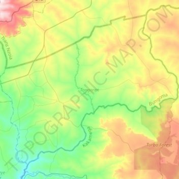
Name: Tongaren topographic map, elevation, terrain.

Location: Tongaren, Bungoma County, Western, Kenya (0.66394 34.80166 0.88603 35.06785)

Average elevation: 1,735 m

Minimum elevation: 1,531 m

Maximum elevation: 2,095 m

Other topographic maps

Click on a map to view its topography, its elevation and its terrain.

Kabuchai

Kenya > Bungoma County

Kabuchai, Bungoma County, Western, Kenya

Average elevation: 1,541 m

Sirisia

Kenya > Bungoma County

Sirisia, Bungoma County, Western, Kenya

Average elevation: 1,550 m

Bumula

Kenya > Bungoma County

Bumula, Bungoma County, Western, Kenya

Average elevation: 1,326 m

Webuye West

Kenya > Bungoma County

Webuye West, Bungoma County, Western, 50205, Kenya

Average elevation: 1,509 m