
Oman fyri Kirkju topographic map
Interactive map
Click on the map to display elevation.
About this map
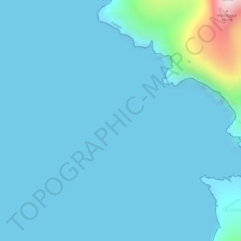
Name: Oman fyri Kirkju topographic map, elevation, terrain.
Location: Oman fyri Kirkju, 870, Faroe Islands (61.51910 -6.92392 61.53910 -6.90392)
Average elevation: 44 m
Minimum elevation: -2 m
Maximum elevation: 585 m
Other topographic maps
Click on a map to view its topography, its elevation and its terrain.