
Hay on Wye topographic map
Interactive map
Click on the map to display elevation.
About this map
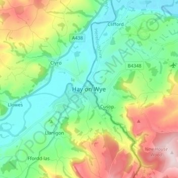
Name: Hay on Wye topographic map, elevation, terrain.
Location: Hay on Wye, Powys, Wales, HR3 5AG, United Kingdom (52.03446 -3.16431 52.11446 -3.08431)
Average elevation: 199 m
Minimum elevation: 64 m
Maximum elevation: 488 m
Other topographic maps
Click on a map to view its topography, its elevation and its terrain.