
Keiyo North topographic map
Interactive map
Click on the map to display elevation.
About this map
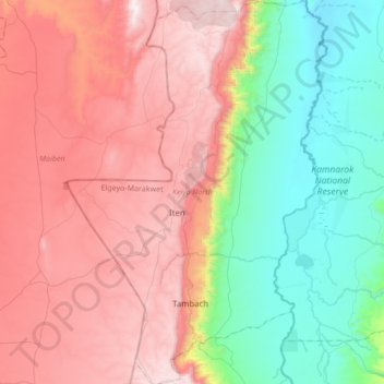
Name: Keiyo North topographic map, elevation, terrain.
Location: Keiyo North, Elgeyo-Marakwet County, Rift Valley, Kenya (0.51998 35.41211 0.86185 35.64412)
Average elevation: 1,761 m
Minimum elevation: 1,019 m
Maximum elevation: 2,600 m
Other topographic maps
Click on a map to view its topography, its elevation and its terrain.
Marakwet West
Kenya > Elgeyo-Marakwet County
Marakwet West, Elgeyo-Marakwet County, Rift Valley, Kenya
Average elevation: 2,056 m