Geolocate

Carmen topographic map

Interactive map

Click on the map to display elevation.

About this map

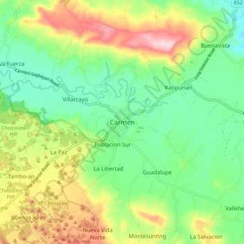
Name: Carmen topographic map, elevation, terrain.

Location: Carmen, Bohol, Central Visayas, 6319, Philippines (9.78433 124.15838 9.86433 124.23838)

Average elevation: 258 m

Minimum elevation: 151 m

Maximum elevation: 439 m

Other topographic maps

Click on a map to view its topography, its elevation and its terrain.

Tagbilaran

Philippines > Bohol

Average elevation: 25 m

Catarman

Philippines > Bohol > Dauis

Average elevation: 39 m

Totolan

Philippines > Bohol > Dauis

Average elevation: 22 m

Loboc River

Philippines > Bohol > Loboc > Camisan

Average elevation: 70 m

Loboc River

Philippines > Bohol

Average elevation: 223 m

Dauis

Philippines > Bohol

Average elevation: 20 m

Songculan

Philippines > Bohol > Dauis

Average elevation: 22 m