
Pililla topographic map
Click on the map to display elevation.
About this map
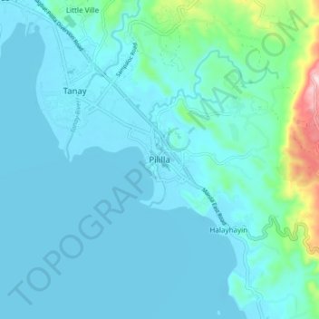
Name: Pililla topographic map, elevation, terrain.
Location: Pililla, Rizal, Calabarzon, 1910, Philippines (14.44118 121.26759 14.52118 121.34759)
Average elevation: 43 m
Minimum elevation: 0 m
Maximum elevation: 362 m
Other topographic maps
Click on a map to view its topography, its elevation and its terrain.