
Pugo topographic map
Click on the map to display elevation.
About this map
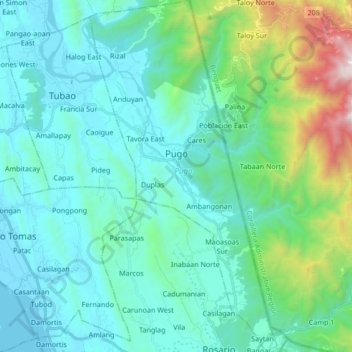
Name: Pugo topographic map, elevation, terrain.
Location: Pugo, La Union, Ilocos Region, 2508, Philippines (16.22890 120.42579 16.39087 120.51544)
Average elevation: 325 m
Minimum elevation: 0 m
Maximum elevation: 1,870 m
Other topographic maps
Click on a map to view its topography, its elevation and its terrain.