
Thank you for supporting this site ❤️
Make a donation
Make a donation
Big C2 topographic map
Click on the map to display elevation.
Thank you for supporting this site ❤️
Make a donation
Make a donation
About this map
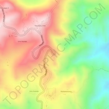
Name: Big C2 topographic map, elevation, terrain.
Location: Big C2, Rizal, Calabarzon, 1964, Philippines (14.56340 121.36234 14.58340 121.38234)
Average elevation: 494 m
Minimum elevation: 301 m
Maximum elevation: 643 m
Thank you for supporting this site ❤️
Make a donation
Make a donation
Other topographic maps
Click on a map to view its topography, its elevation and its terrain.
Thank you for supporting this site ❤️
Make a donation
Make a donation
Thank you for supporting this site ❤️
Make a donation
Make a donation
Thank you for supporting this site ❤️
Make a donation
Make a donation