
Silanguin Cove topographic map
Interactive map
Click on the map to display elevation.
About this map
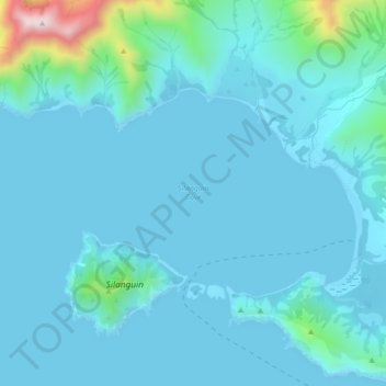
Name: Silanguin Cove topographic map, elevation, terrain.
Location: Silanguin Cove, Zambales, Central Luzon, Philippines (14.76173 120.08953 14.78467 120.13352)
Average elevation: 52 m
Minimum elevation: -2 m
Maximum elevation: 507 m
Other topographic maps
Click on a map to view its topography, its elevation and its terrain.
Cabangan
The municipality has a varied topography characterized by high mountains to narrow coastal plains. The most outstanding feature observable in the municipality is the Zambales Range.
Average elevation: 52 m
San Narciso
San Narciso is located in a relatively flat plain. West of the town is the South China Sea and to the east is bordered by the Sto. Tomas river are the Zambales Mountain Ranges. Average elevation is 3.6 metres (12 ft) above sea level and the highest elevation is 800 metres (2,600 ft) above sea level.
Average elevation: 11 m