
Helensville topographic map
Interactive map
Click on the map to display elevation.
About this map
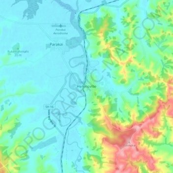
Name: Helensville topographic map, elevation, terrain.
Location: Helensville, Rodney, Auckland, 0800, New Zealand (-36.71992 174.41054 -36.63992 174.49054)
Average elevation: 42 m
Minimum elevation: -2 m
Maximum elevation: 184 m
Auckland trails, hiking, mountain biking, running and outdoor activities
Other topographic maps
Click on a map to view its topography, its elevation and its terrain.