
Waiwera River topographic map
Interactive map
Click on the map to display elevation.
About this map
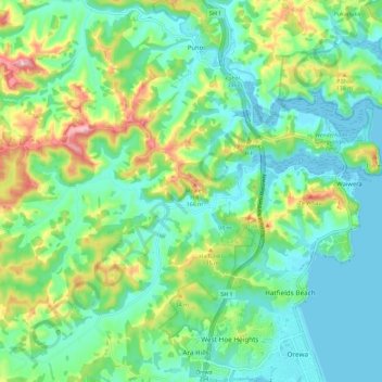
Name: Waiwera River topographic map, elevation, terrain.
Location: Waiwera River, Rodney, Auckland, New Zealand (-36.55564 174.59608 -36.53766 174.71029)
Average elevation: 57 m
Minimum elevation: -1 m
Maximum elevation: 202 m
Auckland trails, hiking, mountain biking, running and outdoor activities
Other topographic maps
Click on a map to view its topography, its elevation and its terrain.