
Waioneke topographic map
Interactive map
Click on the map to display elevation.
About this map
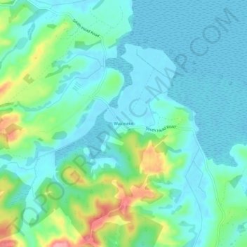
Name: Waioneke topographic map, elevation, terrain.
Location: Waioneke, Rodney, Auckland, New Zealand (-36.56132 174.27789 -36.52132 174.31789)
Average elevation: 27 m
Minimum elevation: -1 m
Maximum elevation: 117 m
Auckland trails, hiking, mountain biking, running and outdoor activities
Other topographic maps
Click on a map to view its topography, its elevation and its terrain.