
Thank you for supporting this site ❤️
Make a donation
Make a donation
Karamea (Red Island) topographic map
Click on the map to display elevation.
Thank you for supporting this site ❤️
Make a donation
Make a donation
About this map
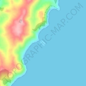
Name: Karamea (Red Island) topographic map, elevation, terrain.
Location: Karamea (Red Island), Hawke's Bay, New Zealand (-39.85906 176.98732 -39.85742 176.98942)
Average elevation: 41 m
Minimum elevation: -1 m
Maximum elevation: 176 m
Hawke's Bay trails, hiking, mountain biking, running and outdoor activities
Thank you for supporting this site ❤️
Make a donation
Make a donation
Other topographic maps
Click on a map to view its topography, its elevation and its terrain.
Thank you for supporting this site ❤️
Make a donation
Make a donation
Thank you for supporting this site ❤️
Make a donation
Make a donation
Thank you for supporting this site ❤️
Make a donation
Make a donation
Thank you for supporting this site ❤️
Make a donation
Make a donation
Thank you for supporting this site ❤️
Make a donation
Make a donation