
Ruapuna topographic map
Interactive map
Click on the map to display elevation.
About this map
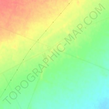
Name: Ruapuna topographic map, elevation, terrain.
Location: Ruapuna, Ashburton District, Canterbury, New Zealand (-43.87331 171.32922 -43.85331 171.34922)
Average elevation: 302 m
Minimum elevation: 275 m
Maximum elevation: 332 m
Other topographic maps
Click on a map to view its topography, its elevation and its terrain.
Ashburton
New Zealand > Canterbury > Ashburton District
Ashburton, Ashburton District, Canterbury, 7700, New Zealand
Average elevation: 99 m
Lake Hood
New Zealand > Canterbury > Ashburton District
Lake Hood, Ashburton District, Canterbury, New Zealand
Average elevation: 64 m
Rakaia
New Zealand > Canterbury > Ashburton District
Rakaia, Ashburton District, Canterbury, 7710, New Zealand
Average elevation: 105 m
Ōtūroto / Lake Heron
New Zealand > Canterbury > Ashburton District
Ōtūroto / Lake Heron, Ashburton District, Canterbury, New Zealand
Average elevation: 750 m
Totara Peak
New Zealand > Canterbury > Ashburton District
Totara Peak, Ashburton District, Canterbury, New Zealand
Average elevation: 1,645 m
Rakaia Gorge lookout
New Zealand > Canterbury > Ashburton District
Rakaia Gorge lookout, Arundel Rakaia Gorge Road, Ashburton District, Canterbury, New Zealand
Average elevation: 358 m
Dromore
New Zealand > Canterbury > Ashburton District
Dromore, Ashburton District, Canterbury, 7772, New Zealand
Average elevation: 123 m
Methven
New Zealand > Canterbury > Ashburton District
Methven, Ashburton District, Canterbury, 7730, New Zealand
Average elevation: 322 m
Hackthorne
New Zealand > Canterbury > Ashburton District
Hackthorne, Ashburton District, Canterbury, New Zealand
Average elevation: 199 m
Mayfield
New Zealand > Canterbury > Ashburton District
Mayfield, Ashburton District, Canterbury, 7778, New Zealand
Average elevation: 266 m
Ashburton Lakes
New Zealand > Canterbury > Ashburton District
Ashburton Lakes, Ashburton District, Canterbury, New Zealand
Average elevation: 645 m
Lake Clearwater
New Zealand > Canterbury > Ashburton District
Lake Clearwater, Ashburton District, Canterbury, New Zealand
Average elevation: 751 m