
Thank you for supporting this site ❤️
Make a donation
Make a donation
Castillejos topographic map
Click on the map to display elevation.
Thank you for supporting this site ❤️
Make a donation
Make a donation
About this map
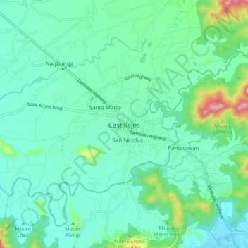
Name: Castillejos topographic map, elevation, terrain.
Location: Castillejos, Zambales, Central Luzon, 2208, Philippines (14.89207 120.16054 14.97207 120.24054)
Average elevation: 59 m
Minimum elevation: 3 m
Maximum elevation: 282 m
Thank you for supporting this site ❤️
Make a donation
Make a donation
Other topographic maps
Click on a map to view its topography, its elevation and its terrain.
Thank you for supporting this site ❤️
Make a donation
Make a donation
Thank you for supporting this site ❤️
Make a donation
Make a donation
Thank you for supporting this site ❤️
Make a donation
Make a donation
Thank you for supporting this site ❤️
Make a donation
Make a donation