
Danseys Pass topographic map
Interactive map
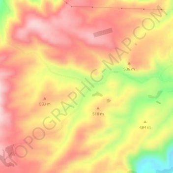
Click on the map to display elevation.
About this map
Name: Danseys Pass topographic map, elevation, terrain.
Location: Danseys Pass, Waitaki District, Canterbury, New Zealand (-44.98442 170.48688 -44.96442 170.50688)
Average elevation: 502 m
Minimum elevation: 337 m
Maximum elevation: 594 m
Canterbury trails, hiking, mountain biking, running and outdoor activities
Other topographic maps
Click on a map to view its topography, its elevation and its terrain.
Akaroa
New Zealand > Canterbury > Christchurch City > Banks Peninsula Community
Average elevation: 152 m
Lake Ōhau
New Zealand > Canterbury > Waitaki District
Wilding Pines (Pinus Cortorta, Pinus sylvestris) are problematic on the foreshore of Lake Ōhau. Pinus contorta grow “probably five to 10 times faster” in the Mackenzie Country (and Lake Ōhau) than in their native North America. They can establish themselves at altitudes of up to 2000 metres. Where they…
Average elevation: 904 m
Kaikōura
The Hutton's shearwater (Puffinus huttoni) or Kaikōura tītī is an endangered seabird in the family Procellariidae. It is found in waters around Australia and New Zealand but it only breeds in the Seaward Kaikōura Range in New Zealand. It is the only seabird in the world that breeds in an alpine…
Average elevation: 530 m
Duvauchelle
New Zealand > Canterbury > Christchurch City > Banks Peninsula Community
Average elevation: 277 m
Okains Bay
New Zealand > Canterbury > Christchurch City > Banks Peninsula Community
Average elevation: 148 m
Le Bons Bay
New Zealand > Canterbury > Christchurch City > Banks Peninsula Community
Average elevation: 244 m
Wainui
New Zealand > Canterbury > Christchurch City > Banks Peninsula Community
Average elevation: 203 m
Halswell-Hornby-Riccarton Community
New Zealand > Canterbury > Christchurch City
Average elevation: 49 m
Bishops Green
New Zealand > Canterbury > Christchurch City > Halswell-Hornby-Riccarton Community
Average elevation: 17 m
Fendalton-Waimari-Harewood Community
New Zealand > Canterbury > Christchurch City
Average elevation: 39 m
Little River
New Zealand > Canterbury > Christchurch City > Banks Peninsula Community
Average elevation: 220 m
Lake Tekapo / Takapō
New Zealand > Canterbury > Mackenzie District
Lake Tekapo (Māori: Takapō) is the second-largest of three roughly parallel lakes running north–south along the northern edge of the Mackenzie Basin in the South Island of New Zealand (the others are Lake Pukaki and Lake Ōhau). It covers an area of 83 square kilometres (32 sq mi) and is at an altitude of…
Average elevation: 1,025 m
Coastal-Burwood Community
New Zealand > Canterbury > Christchurch City > Coastal-Burwood Community
Average elevation: 6 m
Linwood-Central-Heathcote Community
New Zealand > Canterbury > Christchurch City > Linwood-Central-Heathcote Community
Average elevation: 55 m
Orton Bradley Park
New Zealand > Canterbury > Banks Peninsula Community > Charteris Bay
Average elevation: 190 m