
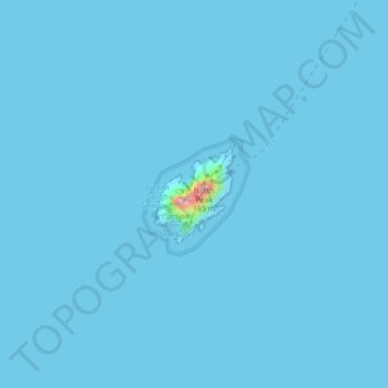
Great Skellig topographic map
Interactive map
Click on the map to display elevation.
About this map
Name: Great Skellig topographic map, elevation, terrain.
Average elevation: 1 m
Minimum elevation: 0 m
Maximum elevation: 161 m
Other topographic maps
Click on a map to view its topography, its elevation and its terrain.
Julianstown
Julianstown was the seat of the Moore family who lived in Julianstown House and occupied the land that now contains the townland of Julianstown West. Taylor and Skinner's 1783 Road Map of Ireland refers to the Moore seat and also shows the Church of Ireland church which still stands today. There is little…
Average elevation: 20 m
Baltinglass
A nineteenth-century explanation is found in Samuel Lewis' A Topographical Dictionary of Ireland, where he says that the name, "according to most antiquaries," comes from Baal-Tin-Glas, meaning the "pure fire of Baal," and that this suggests that the area was a centre for "druidical worship".
Average elevation: 163 m
Dundalk
The main part of the census town lies at sea level. Dún Dealgan Motte at Castletown is the highest point in the urban area at an elevation of 60 m (200 ft). The municipal district includes the Cooley Mountains, with Slieve Foy the highest of the peaks at an elevation of 589 m (1,932 ft).
Average elevation: 14 m
Stratford
According to Lewis's Topographical Dictionary of 1837, Stratford-upon-Slaney was at that time a market town in the barony of Upper Talbotstown 2¼ miles north north east of Baltinglass. At that time the town had 2,833 inhabitants. In 1837 Orr and Co. bought the factory from the Stratford family. Early in the…
Average elevation: 176 m
Shannon
The lower Shannon between Killaloe and Limerick had a topography quite different from the long upper reaches. Here the river falls by 30 m (98 ft) in only 20 km (12 mi). William Ockenden, also from England, was placed in charge of works on this stretch in 1757 and spent £12,000 over the next four years,…
Average elevation: 88 m
County Kilkenny
The River Nore flows through the county, and the River Suir forms the border with County Waterford. Brandon Hill is the highest point with an elevation of 515 m (1,690 ft). Most of the county has a hilly surface of moderate elevation with uplands in the north-east, the north-west and the South of the county;…
Average elevation: 120 m
Limerick
Limerick's climate is classified as temperate oceanic (Köppen Cfb). Met Éireann maintains a climatological weather observation station at Shannon Airport, 21 kilometres west-northwest of the city in County Clare. Shannon Airport records an average of 977 millimetres of precipitation annually, most of which…
Average elevation: 45 m
Cork
The climate of Cork, like the majority of Ireland, is mild oceanic (Cfb in the Köppen climate classification) and changeable with abundant rainfall and a lack of temperature extremes. Cork lies in plant Hardiness zone 9b. Met Éireann maintains a climatological weather station at Cork Airport, a few…
Average elevation: 79 m
County Carlow
The soils of the county are mostly derived from glacial till, rather than solid bedrock geology. These typically consist of a mix of clay, sand and gravel. Occasionally glacial melt-water would form a long ridge of sand and gravel known as an esker. One such example is preserved within the county and is a…
Average elevation: 126 m