
Make a donation
Manila Bay topographic map
Click on the map to display elevation.
Make a donation
About this map
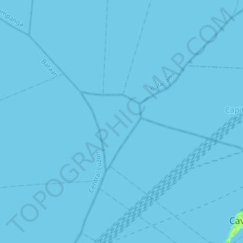
Name: Manila Bay topographic map, elevation, terrain.
Location: Manila Bay, Cavite, Calabarzon, Philippines (14.46068 120.64643 14.70535 120.89925)
Average elevation: 0 m
Minimum elevation: 0 m
Maximum elevation: 8 m
Make a donation
Other topographic maps
Click on a map to view its topography, its elevation and its terrain.
Tagaytay
Philippines > Cavite > Tagaytay > Tagaytay
The southern and eastern portions of Tagaytay are covered by hills and mountains which is generally forests, pine trees and open grasslands. The city lies along Tagaytay Ridge, a ridge stretching about 32 kilometres (20 mi) from Mount Batulao in the west to Mount Sungay in the east with elevations averaging…
Average elevation: 229 m
Corregidor Island
Philippines > Cavite > Cavite City
The tadpole-shaped island, with its tail running eastward, is about 6.5 km (4.0 mi) long, about 2.0 km (1.2 mi) wide at its widest with a total land area of about 900 hectares (2,200 acres). The highest elevation is at 180 m (590 ft) on the Topside. The island is divided into four sections.
Average elevation: 11 m
Make a donation
Mount Sungay
Philippines > Cavite > Tagaytay > Iruhin South
Mount Sungay is the eastern end of the Tagaytay Range, or more commonly known as the Tagaytay Ridge, a 32-kilometre (20 mi) ridge located at the southern part of the province with elevations averaging about 600 m (2,000 ft) above sea level. The ridge stretches west-southwest from Mount Sungay to Mount Batulao…
Average elevation: 501 m
Make a donation
Make a donation
Make a donation
Make a donation
Make a donation
Make a donation
Make a donation
Ayala Westgrove Heights
Philippines > Cavite > Silang > Ayala Westgrove Heights
Average elevation: 210 m
Make a donation
Make a donation
Make a donation
Make a donation
Make a donation
Make a donation
Make a donation
Make a donation
Heart Foundation Subd. PHASE 2. Brgy. Punta 1, Tanza Cavite
Philippines > Cavite > Tanza > Bukal
Average elevation: 29 m
Make a donation
Make a donation
Make a donation
Make a donation
Make a donation
Make a donation
Make a donation