
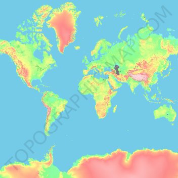
France topographic map
Interactive map
Click on the map to display elevation.
About this map
Name: France topographic map, elevation, terrain.
Location: France (-50.21872 -178.38737 51.30557 172.30572)
Average elevation: 430 m
Minimum elevation: -30 m
Maximum elevation: 6,542 m
Metropolitan France has a wide variety of topographical sets and natural landscapes. Large parts of the current territory of France were raised during several tectonic episodes like the Hercynian uplift in the Paleozoic Era, during which the Armorican Massif, the Massif Central, the Morvan, the Vosges and Ardennes ranges and the island of Corsica were formed. These massifs delineate several sedimentary basins such as the Aquitaine basin in the southwest and the Paris basin in the north, the latter including several areas of particularly fertile ground such as the silt beds of Beauce and Brie. Various routes of natural passage, such as the Rhône Valley, allow easy communication. The Alpine, Pyrenean and Jura mountains are much younger and have less eroded forms. At 4,810.45 metres (15,782 ft) above sea level, Mont Blanc, located in the Alps on the French and Italian border, is the highest point in Western Europe. Although 60% of municipalities are classified as having seismic risks, these risks remain moderate.
Other topographic maps
Click on a map to view its topography, its elevation and its terrain.
Philippines
Philippines
Average elevation: 33 m
Las Vegas
United States > Nevada > Clark County
Las Vegas, Clark County, Nevada, United States
Average elevation: 756 m
Davao City
Philippines > Davao Occidental > Davao City
Davao City, Davao Occidental, Davao Region, Philippines
Average elevation: 303 m
Auckland
Auckland, Waitematā, Auckland, 1010, New Zealand
Average elevation: 32 m
Wellington
New Zealand > Wellington > Wellington City
Wellington, Wellington City, Wellington, 6011, New Zealand
Average elevation: 85 m
Baguio
Philippines > Benguet > Baguio
Baguio, Benguet, Cordillera Administrative Region, 2600, Philippines
Average elevation: 882 m
Dunedin
New Zealand > Otago > Dunedin City
Dunedin, Dunedin City, Otago, 9054, New Zealand
Average elevation: 110 m
Christchurch City
Christchurch City, Canterbury, New Zealand
Average elevation: 74 m
Sarandi
Sarandi, Região Geográfica Imediata de Carazinho, Região Geográfica Intermediária de Passo Fundo, Rio Grande do Sul, South Region, Brazil
Average elevation: 511 m
Rangiaowhia War Memorial Domain
New Zealand > Waikato > Waipa District > Kihikihi > Rangiaowhia
Rangiaowhia War Memorial Domain, Rangiaowhia, Kihikihi, Waipa District, Waikato, New Zealand
Average elevation: 69 m
Timaru
New Zealand > Canterbury > Timaru District
Timaru, Timaru District, Canterbury, 7910, New Zealand
Average elevation: 16 m
San Jose del Monte
San Jose del Monte, Bulacan, Central Luzon, 3023, Philippines
Average elevation: 106 m
Pachacámac
Pachacámac, Lurín, Province of Lima, Lima, Peru
Average elevation: 327 m
Jerusalem
Israel > Jerusalem District > Jerusalem
Jerusalem, Jerusalem District, Israel
Average elevation: 661 m
Parañaque
Philippines > Parañaque > Parañaque
Parañaque, Southern Manila District, Metro Manila, Philippines
Average elevation: 11 m
Sandunpura
Sandunpura, Ampara District, Eastern Province, Sri Lanka
Average elevation: 89 m
Halang
Philippines > Cavite > Naic
Halang, Naic, Cavite, Calabarzon, 4110, Philippines
Average elevation: 44 m
General Trias
General Trias, Cavite, Calabarzon, 4107, Philippines
Average elevation: 85 m
York County
York County, Pennsylvania, United States
Average elevation: 170 m
Brisbane
Australia > Queensland > Brisbane
Brisbane, Queensland, 4000, Australia
Average elevation: 45 m
Hamilton
New Zealand > Waikato > Hamilton City > Hamilton
Hamilton, Hamilton City, Waikato, 03204, New Zealand
Average elevation: 53 m
Tagum
Tagum, Davao del Norte, Davao Region, 8100, Philippines
Average elevation: 91 m
Mandaui Island
Philippines > Occidental Mindoro > Looc > Ambil
Mandaui Island, Ambil, Looc, Occidental Mindoro, Mimaropa, Philippines
Average elevation: 1 m
Los Altos
Los Altos, Burgos, Castile and León, 09551, Spain
Average elevation: 920 m
Havila
Philippines > Rizal > Taytay
Havila, Taytay, Rizal, Calabarzon, 1880, Philippines
Average elevation: 106 m
Siripura
Sri Lanka > North Central Province
Siripura, Polonnaruwa District, North Central Province, Sri Lanka
Average elevation: 70 m
Narammala
Sri Lanka > North Western Province
Narammala, Kurunegala District, North Western Province, 60100, Sri Lanka
Average elevation: 81 m
Girandurukotte
Girandurukotte, Badulla District, Uva Province, Sri Lanka
Average elevation: 96 m
Los Gatos
United States > California > Santa Clara County
Los Gatos, Santa Clara County, California, 95030, United States
Average elevation: 209 m
Dambadeniya
Sri Lanka > North Western Province
Dambadeniya, Kurunegala District, North Western Province, 60130, Sri Lanka
Average elevation: 64 m
Mawathagama
Sri Lanka > North Western Province
Mawathagama, Kurunegala District, North Western Province, Sri Lanka
Average elevation: 199 m
Tamlangon
Philippines > Davao del Sur > Matanao
Tamlangon, Matanao, Davao del Sur, Davao Region, 8003, Philippines
Average elevation: 61 m
Ocheretyne
Ocheretyne, Ocheretyne settlement hromada, Pokrovskii Raion, Donetsk Oblast, 86020, Ukraine
Average elevation: 227 m
Tagaytay
Philippines > Cavite > Tagaytay > Tagaytay
Tagaytay, Cavite, Calabarzon, 4120, Philippines
Average elevation: 229 m
North Shore
New Zealand > Auckland > Kaipātiki
North Shore, Tōtara Vale, Kaipātiki, Auckland, 0629, New Zealand
Average elevation: 57 m
Calamba
Philippines > Laguna > Calamba > Calamba
Calamba, Laguna, Calabarzon, 4027, Philippines
Average elevation: 100 m
Auckland Domain
New Zealand > Auckland > Auckland
Auckland Domain, Parnell, Auckland, Waitematā, Auckland, New Zealand
Average elevation: 49 m
Waiheke Island
New Zealand > Auckland > Waiheke
Waiheke Island, Waiheke, Auckland, New Zealand
Average elevation: 16 m
Chino
United States > California > San Bernardino County
Chino, San Bernardino County, California, United States
Average elevation: 239 m
Lower Hutt
New Zealand > Wellington > Lower Hutt City
Lower Hutt, Lower Hutt City, Wellington, 5040, New Zealand
Average elevation: 173 m
Queenstown
New Zealand > Otago > Queenstown-Lakes District
Queenstown, Queenstown-Lakes District, Otago, 9348, New Zealand
Average elevation: 592 m