
Stony Brook topographic map
Interactive map
Click on the map to display elevation.
About this map
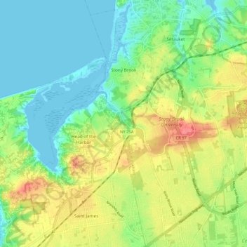
Name: Stony Brook topographic map, elevation, terrain.
Location: Stony Brook, Suffolk County, New York, United States (40.86922 -73.15211 40.94811 -73.09649)
Average elevation: 29 m
Minimum elevation: -1 m
Maximum elevation: 78 m
Other topographic maps
Click on a map to view its topography, its elevation and its terrain.
Long Island
The land to the south of this moraine to the South Shore is the outwash plain of the last glacier. One part of the outwash plain was known as the Hempstead Plains, and this land contained one of the few natural prairies to exist east of the Appalachian Mountains. The glaciers melted and receded to the north,…
Average elevation: 42 m
Staten Island
United States > New York > New York
The highest point on the island, the summit of Todt Hill, elevation 401 ft (122 m), is also the highest point in the five boroughs, as well as the highest point on the Atlantic coastal plain south of Great Blue Hill in Massachusetts and the highest point on the coast proper south of Maine's Camden Hills.…
Average elevation: 9 m
City of Rome
United States > New York > Oneida County
The critical east/west American trade route through the frontier was improved by construction of the Erie Canal. On July 4, 1817, construction on the canal began in Rome. The Erie Canal reaches a summit in Rome, attaining an elevation of 420 feet. The first phase was completed in 1825, connecting the Hudson…
Average elevation: 190 m
Village of Haverstraw
United States > New York > Rockland County > Town of Haverstraw
September 2004 marked the village's 150th anniversary, celebrated by a festival along the village's waterfront. The village has entered a period of revitalization, which coincides with the creation of the Harbors at Haverstraw Community and a sculpture trail which will follow the Hudson River shoreline. The…
Average elevation: 44 m
Village of Bronxville
United States > New York > Westchester County > Town of Eastchester
Average elevation: 48 m
Village of DeRuyter
United States > New York > Madison County > Town of DeRuyter
Average elevation: 432 m
Chautauqua County
The county is generally composed of rolling hills and valleys, with elevations ranging anywhere between 1100 and 2100 feet, although the land within a few miles of Lake Erie is generally flat and at an elevation of 1000 feet or lower. The lowest point in the county is Lake Erie, at 571 feet (174 meters), and…
Average elevation: 328 m
City of Utica
United States > New York > Oneida County
The city's Mohawk name, Unundadages ("around the hill") refers to a bend in the Mohawk River that flows around the city's elevated position as seen from the Deerfield Hills in the north. The Erie Canal and Mohawk River pass through northern Utica; northwest of downtown is the Utica Marsh, a group of cattail…
Average elevation: 183 m
Quaker Ridge
United States > New York > Westchester County > City of New Rochelle
Average elevation: 65 m
Village of Valley Stream
United States > New York > Nassau County
At this time, the community did not have a post office, so residents had to pick up their mail in the village of Hempstead. After Pagan petitioned authorities for a post office, he was appointed postmaster and it was based in his farmhouse, now known as the Pagan-Fletcher House. He was advised that the…
Average elevation: 7 m
Central Park
United States > New York > New York County > New York
In June 1856, Fernando Wood appointed a "consulting board" of seven people, headed by author Washington Irving, to inspire public confidence in the proposed development. Wood hired military engineer Egbert Ludovicus Viele as the park's chief engineer, tasking him with a topographical survey of the site. The…
Average elevation: 26 m
New York
The city's land has been altered substantially by human intervention, with considerable land reclamation along the waterfronts since Dutch colonial times; reclamation is most prominent in Lower Manhattan, with developments such as Battery Park City in the 1970s and 1980s. Some of the natural relief in…
Average elevation: 19 m