
Mokau River topographic map
Interactive map
Click on the map to display elevation.
About this map
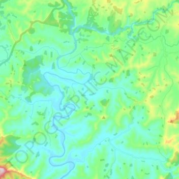
Name: Mokau River topographic map, elevation, terrain.
Location: Mokau River, Waitomo District, Waikato, New Zealand (-38.63799 174.89083 -38.52978 175.00834)
Average elevation: 110 m
Minimum elevation: 21 m
Maximum elevation: 472 m
Waikato trails, hiking, mountain biking, running and outdoor activities
Other topographic maps
Click on a map to view its topography, its elevation and its terrain.
Matarangi Bluff
New Zealand > Waikato > Thames-Coromandel District > Rings Beach
Average elevation: 21 m