
Make a donation
New Zealand topographic map
Click on the map to display elevation.
Make a donation
New Zealand
New Zealand (Māori: Aotearoa [aɔˈtɛaɾɔa]) is an island country in the southwestern Pacific Ocean. It consists of two main landmasses—the North Island (Te Ika-a-Māui) and the South Island (Te Waipounamu)—and over 700 smaller islands. It is the sixth-largest island country by area, covering 268,021 square kilometres (103,500 sq mi). New Zealand is about 2,000 kilometres (1,200 mi) east of Australia across the Tasman Sea and 1,000 kilometres (600 mi) south of the islands of New Caledonia, Fiji, and Tonga. The country's varied topography and sharp mountain peaks, including the Southern Alps, owe much to tectonic uplift and volcanic eruptions. New Zealand's capital city is Wellington, and its most populous city is Auckland.
Make a donation
About this map
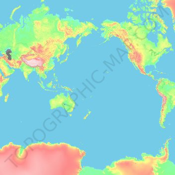
Name: New Zealand topographic map, elevation, terrain.
Location: New Zealand (-52.82137 -179.05915 -29.03033 179.36436)
Average elevation: 399 m
Minimum elevation: -30 m
Maximum elevation: 6,245 m
New Zealand trails, hiking, mountain biking, running and outdoor activities
Make a donation
Other topographic maps
Click on a map to view its topography, its elevation and its terrain.
Auckland
The Auckland Volcanic Field has contributed greatly to the growth and prosperity of the Auckland Region since the area was settled by humans. Initially, the maunga (scoria cones) were occupied and established as pā (fortified settlements) by Māori due to the strategic advantage their elevation provided in…
Average elevation: 32 m
Wellington
New Zealand > Wellington > Wellington City
Averaging 2,055 hours of sunshine per year, the climate of Wellington is temperate marine, (Köppen: Cfb), generally moderate all year round with warm summers and mild winters, and rarely sees temperatures above 23 °C (73 °F) or below 4 °C (39 °F). The hottest recorded temperature in the city is 31.1 °C…
Average elevation: 85 m
Make a donation
Clark
The development is not a flood-prone area with its minimum elevation being at 54 metres (177 ft) above sea level and its planned central park also serves as a flood catchment basin. The Sierra Madre mountain range is located on the development's east while the Zambales mountain range is located on the west,…
Average elevation: 190 m
Queenstown
New Zealand > Queenstown-Lakes District
The town is at a relatively low altitude for a ski and snowboarding centre, at 310 metres (1,020 ft) above sea level at the lake shore, but is nestled among mountains, most notably the scenic attraction of The Remarkables, to the town's southeast. Below the lake lies the deep Kawarau Gorge, and there are…
Average elevation: 592 m
Tagaytay
Philippines > Cavite > Tagaytay > Tagaytay
The southern and eastern portions of Tagaytay are covered by hills and mountains which is generally forests, pine trees and open grasslands. The city lies along Tagaytay Ridge, a ridge stretching about 32 kilometres (20 mi) from Mount Batulao in the west to Mount Sungay in the east with elevations averaging…
Average elevation: 229 m
Make a donation
Antsirabe
Madagascar > Vakinankaratra > Antsirabe I
Antsirabe is situated at an altitude of about 1,500 m (4,900 ft), making its subtropical highland climate (Köppen: Cwb), similar to Brazilian high cities of the southeast. During the winter the temperature can fall below 0 °C (32 °F) at night, and Antsirabe has recorded the lowest temperature in Madagascar…
Average elevation: 1,671 m
Make a donation
Washington, D.C.
United States of America > Washington, D.C. > Washington, D.C.
The highest natural elevation in the District is 409 feet (125 m) above sea level at Fort Reno Park in upper northwest Washington. The lowest point is sea level at the Potomac River. The geographic center of Washington is near the intersection of 4th and L Streets NW.
Average elevation: 63 m
Dunedin
New Zealand > Otago > Dunedin City
The climate of Dunedin in general is temperate. The city is recognised as having a large number of microclimates and the weather conditions often vary between suburbs mostly due to the city's topographical layout. Under the Köppen climate classification, Dunedin features an oceanic climate. The city's climate…
Average elevation: 110 m
Marabi
Spain > Autonomous Community of the Basque Country > Amorebieta-Etxano
Average elevation: 161 m
Make a donation
San Jose del Monte
The elevation of the city ranges from approximately 40 to 900 meters (130 to 2,950 ft) above sea level; the relief transitions from warm lowland to cool upland as one goes eastward. This is because the city is part of the Sierra Madre mountain range. Plains and river valley flats characterize the western and…
Average elevation: 106 m
Baguio
Philippines > Benguet > Baguio
In 1903, Filipinos, Japanese and Chinese workers were hired to build Kennon Road, the first road directly connecting Baguio with the lowlands of La Union and Pangasinan. Before this, the only road to Benguet was Naguilian Road, and it was largely a horse trail at higher elevations. Camp John Hay was…
Average elevation: 882 m
Make a donation
Make a donation
Make a donation
Calinog
The landscape of Calinog varies from flat, low-lying areas to rolling hills and mountain ranges. The recorded elevation for Calinog is 55 meters, though this likely refers to the town proper and does not reflect the higher mountain ranges.
Average elevation: 75 m
Make a donation
Make a donation
Make a donation
Make a donation
Antipolo
Its higher elevation than that of Metro Manila affords it a scenic view of the metropolis, especially at night. Its locally grown mangoes and cashews are popular among tourists, as well as suman – a local delicacy made out of glutinous rice. The Hinulugang Taktak National Park, which was once a popular…
Average elevation: 125 m
Make a donation
Make a donation
Make a donation
Masherbrum
Pakistan > Gilgit-Baltistan > Shigar District
Masherbrum (Urdu: مشہ بروم ; formerly known as K1) is a mountain located in the Ghanche District in the Gilgit Baltistan region of Pakistan. With an elevation of 7,821 metres (25,659 feet), it ranks as the 22nd highest mountain globally and the 9th highest in Pakistan. It holds the distinction of being…
Average elevation: 6,469 m
Make a donation
Heard Island
Heard Island, by far the largest of the group, is a 368-square-kilometre (142 sq mi) mountainous island covered by 41 glaciers; 80% of the island is covered with ice. The Big Ben massif dominates the island: It has a maximum elevation of 2,745 metres (9,006 ft) at Mawson Peak, the historically active volcanic…
Average elevation: 120 m
Purerua Peninsula
New Zealand > Northland > Far North District > Bay of Islands
Average elevation: 34 m
Make a donation
Rooikoppies Dam
South Africa > North West > Bojanala Platinum District Municipality > Madibeng Local Municipality
Average elevation: 1,047 m
Make a donation
Make a donation
Make a donation
Kruzenshtern
Russia > Arkhangelsk Oblast > Novaya Zemlya Urban Okrug
The mountain was first put on the map in the 1820s by Arctic explorer Fyodor Litke (1797–1882) following his Novaya Zemlya explorations. It was named after Imperial Russian Navy Admiral Ivan Kruzenshtern (1770–1846). The mountain's name must have been known to Soviet topographers, but for undisclosed…
Average elevation: 1,046 m
Make a donation