
Fairdown topographic map
Click on the map to display elevation.
About this map
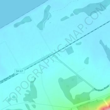
Name: Fairdown topographic map, elevation, terrain.
Location: Fairdown, Buller District, West Coast, New Zealand (-41.74762 171.69637 -41.72762 171.71637)
Average elevation: 14 m
Minimum elevation: 0 m
Maximum elevation: 175 m
New Zealand trails, hiking, mountain biking, running and outdoor activities
Other topographic maps
Click on a map to view its topography, its elevation and its terrain.
Auckland
The Auckland Volcanic Field has contributed greatly to the growth and prosperity of the Auckland Region since the area was settled by humans. Initially, the maunga (scoria cones) were occupied and established as pā (fortified settlements) by Māori due to the strategic advantage their elevation provided in…
Average elevation: 30 m
Lake Wakatipu
New Zealand > Otago > Queenstown-Lakes District
With a length of 80 kilometres (50 mi), it is New Zealand's longest lake, and, at 289 km2 (112 sq mi), its third largest. The lake is also very deep, its floor being below sea level (−110 metres), with a maximum depth of 420 metres (1,380 ft). It is at an altitude of 310 metres (1,020 ft), towards the…
Average elevation: 952 m
Te Ara a Kewa / Foveaux Strait
The French navigator Jules de Blosseville on board a French expeditionary vessel Coquille, was the first person to describe the strait in detail. He wrote in 1823: "Whirlpools are frequently to be met with and the position is one of great peril when the direction of the waves is contrary to that of the wind".…
Average elevation: 30 m
Le Bons Bay
New Zealand > Canterbury > Christchurch City > Banks Peninsula Community
Average elevation: 244 m
Spenmoor Street Reserve
New Zealand > Wellington > Wellington City > Wellington
Average elevation: 151 m
Akaroa
New Zealand > Canterbury > Christchurch City > Banks Peninsula Community
Average elevation: 152 m
Kaeo River
New Zealand > Northland > Far North District > Bay of Islands-Whangaroa Community
Average elevation: 121 m
Bethells Beach
New Zealand > Auckland > Waitakere Ranges > Te Henga / Bethells Beach
Average elevation: 33 m
Papamoa Hills Regional Park
New Zealand > Bay of Plenty > Western Bay of Plenty District
Average elevation: 53 m
Lake Ōhau
New Zealand > Canterbury > Waitaki District
Wilding Pines (Pinus Cortorta, Pinus sylvestris) are problematic on the foreshore of Lake Ōhau. Pinus contorta grow “probably five to 10 times faster” in the Mackenzie Country (and Lake Ōhau) than in their native North America. They can establish themselves at altitudes of up to 2000 metres. Where they…
Average elevation: 904 m
Hikuraki / North Mavora Lake
New Zealand > Southland > Southland District > Fiordland Community
Average elevation: 1,071 m
Lake Te Anau
New Zealand > Southland > Southland District
Lake Te Anau (Māori: Te Ana-au) is in the southwestern corner of the South Island of New Zealand. The lake covers an area of 344 km2 (133 sq mi), making it the second-largest lake by surface area in New Zealand (after Lake Taupō) and the largest in the South Island. It is the second largest lake in…
Average elevation: 684 m
Little River
New Zealand > Canterbury > Christchurch City > Banks Peninsula Community
Average elevation: 220 m
Lake Hāwea
New Zealand > Otago > Queenstown-Lakes District
Lake Hāwea is New Zealand's ninth largest lake located on the South Island in the Otago Region at an altitude of 348 m. It covers 141 km2 and is 392 m deep.
Average elevation: 864 m
Orton Bradley Park
New Zealand > Canterbury > Banks Peninsula Community > Charteris Bay
Average elevation: 190 m
Whakawhiti Stream
New Zealand > Far North District > Bay of Islands-Whangaroa Community > Manawaora
Average elevation: 58 m
Little River
New Zealand > Southland > Southland District > Stewart Island/Rakiura Community
Average elevation: 62 m
Lake Brunner
New Zealand > West Coast > Grey District > Moana
Lake Brunner is the largest lake in the West Coast region, 10 km (6.2 mi) across with an area of 4061 ha, just over 40 km2 (15 sq mi). The outlet of the lake is the Arnold River, a tributary of the Grey River / Māwheranui, next to the largest settlement of Moana, on the north shore of the lake. The largest…
Average elevation: 168 m